Category:Franklinton (Columbus, Ohio)
Jump to navigation
Jump to search
human settlement in Columbus, Ohio, United States of America  | |||||
| Upload media | |||||
| Instance of | |||||
|---|---|---|---|---|---|
| Named after | |||||
| Location | Columbus, Franklin County, Ohio | ||||
| Founded by | |||||
 | |||||
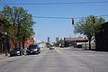
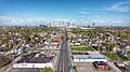
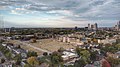
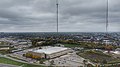
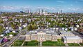
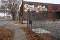
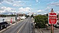
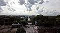
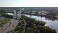
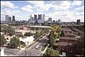
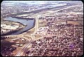
English: Franklinton is a neighborhood bordered by the Scioto River on the north and east, Harmon Avenue on the east, Stimmel Road and Greenlawn Avenue on the south, and Interstate 70 on the west. West Broad Street, or US 40, is one of the country's first roads and is Franklinton's main throughway. It is the neighborhood immediately west of Downtown. It gets its colorful nickname of "The Bottoms" because much of the land lies below the level of the Scioto and Olentangy rivers, and a floodwall is required to contain the rivers and protect the area from devastating floods. Just to the west of Franklinton is a group of smaller neighborhoods commonly referred to as "The Hilltop."
Subcategories
This category has the following 24 subcategories, out of 24 total.
1
- 120 S. Central Avenue (8 F)
A
- Avondale Elementary School (5 F)
B
- B&T Metals (5 F)
- Bellows School (10 F)
C
- Chicago Avenue School (3 F)
E
- Engine House No. 10 (5 F)
- Engine House No. 6 (65 F)
F
- Franklinton Cemetery (10 F)
- Franklinton Post Office (19 F)
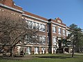
- Franklinton School (5 F)
G
- Green Lawn Abbey (29 F)
H
- Holy Family School (6 F)
L
- Lucas Sullivant House (6 F)
M
- Mount Carmel West (48 F)
O
S
- Sullivant Land Office (8 F)
W
Media in category "Franklinton (Columbus, Ohio)"
The following 200 files are in this category, out of 202 total.
(previous page) (next page)-
 032109 Dana Avenue School--Columbus, Ohio (14).jpg 1,024 × 768; 168 KB
-
 061412 Franklinton School -2--columbus, Ohio (1).jpg 4,608 × 3,456; 3.3 MB
-
 115 - 123 McDowell Street.jpg 6,000 × 4,000; 2.57 MB
-
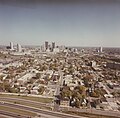
 Aerial views of downtown Columbus - DPLA - 1aa40d90c28640dd700f406820a645f7 (page 1).jpg 2,984 × 2,854; 884 KB
-
 Aerial views of downtown Columbus - DPLA - 1aa40d90c28640dd700f406820a645f7 (page 2).jpg 2,984 × 2,854; 929 KB
-
 Aerial views of downtown Columbus - DPLA - 1aa40d90c28640dd700f406820a645f7 (page 3).jpg 2,910 × 2,854; 924 KB
-
 Aerial views of downtown Columbus - DPLA - 1aa40d90c28640dd700f406820a645f7 (page 5).jpg 2,963 × 2,854; 898 KB
-
 Aerial views of downtown Columbus - DPLA - 1aa40d90c28640dd700f406820a645f7 (page 6).jpg 2,963 × 2,854; 892 KB
-
 Aerial views of downtown Columbus - DPLA - 1aa40d90c28640dd700f406820a645f7 (page 8).jpg 2,963 × 2,854; 912 KB
-
 Bottoms Up Coffee Co-Op side.jpg 5,456 × 3,632; 6.69 MB
-
 Bottoms Up Coffee Co-Op.jpg 5,456 × 3,632; 5.75 MB
-
 Broad St. in Franklinton.jpg 5,456 × 3,632; 7.31 MB
-
 Broad Street in Franklinton 01.jpg 3,113 × 1,751; 2.44 MB
-
 Broad Street in Franklinton 01a.jpg 2,184 × 906; 774 KB
-
 Broad Street in Franklinton.jpg 4,000 × 2,250; 2.15 MB
-
 Broad Street, Franklinton.jpg 5,456 × 3,632; 6.25 MB
-
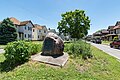
 Centennial Rock.jpg 4,608 × 2,592; 6.63 MB
-
 Columbus Historical Society.jpg 5,325 × 3,375; 10.36 MB
-
 Columbus Idea Foundry.jpg 4,032 × 3,024; 2.78 MB
-
 Columbus Karma Thegsum Choling.jpg 5,603 × 3,735; 2.18 MB
-
 Columbus transportation.jpg 6,000 × 4,000; 19.03 MB
-
 Columbus, OH - Franklinton Flood Wall.jpg 1,846 × 2,145; 3.08 MB
-
 Columbus, OH - OBM office.jpg 1,846 × 2,466; 1.73 MB
-
 Columbus, Ohio 287.jpg 4,320 × 3,240; 5.44 MB
-
 Columbus, Ohio 288.jpg 4,320 × 3,240; 5.6 MB
-
 Columbus, Ohio 289.jpg 4,320 × 3,240; 5.57 MB
-
 Columbus, Ohio 290.jpg 4,320 × 3,240; 5.59 MB
-
 Columbus, Ohio 291.jpg 4,320 × 3,240; 5.6 MB
-
 Columbus, Ohio 292.jpg 4,320 × 3,240; 4.06 MB
-
 Columbus, Ohio 293.jpg 4,320 × 3,240; 5.65 MB
-
 Columbus, Ohio 294.jpg 4,320 × 3,240; 5.59 MB
-
 Columbus, Ohio 295.jpg 4,320 × 3,240; 5.42 MB
-
 Columbus, Ohio 296.jpg 3,240 × 4,320; 5.39 MB
-
 Columbus, Ohio 297.jpg 4,320 × 3,240; 4.94 MB
-
 Columbus, Ohio 298.jpg 4,320 × 3,240; 5.53 MB
-
 Columbus, Ohio 299.jpg 4,320 × 3,240; 5.34 MB
-
 Columbus, Ohio 300.jpg 4,320 × 3,240; 5.34 MB
-
 Columbus, Ohio 301.jpg 3,240 × 4,320; 5.34 MB
-
 Columbus, Ohio 302.jpg 3,240 × 4,320; 5.31 MB
-
 Columbus, Ohio 303.jpg 4,320 × 3,240; 5.43 MB
-
 Columbus, Ohio 304.jpg 4,320 × 3,240; 5.77 MB
-
 Columbus, Ohio 305.jpg 4,320 × 3,240; 5.58 MB
-
 Columbus, Ohio 306.jpg 4,320 × 3,240; 5.42 MB
-
 Columbus, Ohio 307.jpg 4,320 × 3,240; 5.43 MB
-
 Columbus, Ohio 308.jpg 4,320 × 3,240; 5.38 MB
-
 Columbus, Ohio 309.jpg 4,320 × 3,240; 5.55 MB
-
 Columbus, Ohio 310.jpg 4,320 × 3,240; 5.82 MB
-
 Columbus, Ohio 311.jpg 4,320 × 3,240; 5.51 MB
-
 Columbus, Ohio 312.jpg 4,320 × 3,240; 5.68 MB
-
 Columbus, Ohio 313.jpg 4,320 × 3,240; 5.59 MB
-
 Columbus, Ohio 314.jpg 4,320 × 3,240; 5.45 MB
-
 Columbus, Ohio 315.jpg 4,320 × 3,240; 5.25 MB
-
 Columbus, Ohio 316.jpg 3,240 × 4,320; 5.85 MB
-
 Columbus, Ohio 317.jpg 4,320 × 3,240; 5.12 MB
-
 Columbus, Ohio 318.jpg 4,320 × 3,240; 4.94 MB
-
 Columbus, Ohio 319.jpg 4,320 × 3,240; 4.95 MB
-
 Columbus, Ohio 320.jpg 3,240 × 4,320; 5.3 MB
-
 Columbus, Ohio 321.jpg 3,240 × 4,320; 4.4 MB
-
 Columbus, Ohio 322.jpg 4,320 × 3,240; 5.37 MB
-
 Columbus, Ohio 323.jpg 4,320 × 3,240; 5.48 MB
-
 Columbus, Ohio 324.jpg 4,320 × 3,240; 5.27 MB
-
 Columbus, Ohio 325.jpg 4,320 × 3,240; 5.52 MB
-
 Columbus, Ohio 326.jpg 4,320 × 3,240; 5.43 MB
-
 Columbus, Ohio 327.jpg 4,320 × 3,240; 5.49 MB
-
 Columbus, Ohio 328.jpg 4,320 × 3,240; 5.5 MB
-
 Columbus, Ohio 329.jpg 4,320 × 3,240; 5.35 MB
-
 Columbus, Ohio 330.jpg 4,320 × 3,240; 5.57 MB
-
 Columbus, Ohio 331.jpg 4,320 × 3,240; 5.82 MB
-
 Columbus, Ohio 332.jpg 4,320 × 3,240; 5.85 MB
-
 Columbus, Ohio 333.jpg 4,320 × 3,240; 5.84 MB
-
 Columbus, Ohio 334.jpg 4,320 × 3,240; 5.52 MB
-
 Columbus, Ohio 335.jpg 4,320 × 3,240; 5.47 MB
-
 Columbus, Ohio 336.jpg 4,320 × 3,240; 5.13 MB
-
 Columbus, Ohio 337.jpg 4,320 × 3,240; 5.54 MB
-
 Columbus, Ohio 338.jpg 4,320 × 3,240; 5.53 MB
-
 Columbus, Ohio 339.jpg 4,320 × 3,240; 5.71 MB
-
 Columbus, Ohio 340.jpg 4,320 × 3,240; 5.42 MB
-
 Columbus, Ohio 341.jpg 4,320 × 3,240; 5.27 MB
-
 Columbus, Ohio 342.jpg 4,320 × 3,240; 5.56 MB
-
 Columbus, Ohio 343.jpg 4,320 × 3,240; 5.49 MB
-
 Columbus, Ohio 344.jpg 4,320 × 3,240; 5.63 MB
-
 Columbus, Ohio 345.jpg 3,240 × 4,320; 5.3 MB
-
 Columbus, Ohio 346.jpg 4,320 × 3,240; 4.99 MB
-
 Columbus, Ohio 347.jpg 4,320 × 3,240; 5.09 MB
-
 Columbus, Ohio 348.jpg 4,320 × 3,240; 5.43 MB
-
 Columbus, Ohio 349.jpg 4,320 × 3,240; 5.53 MB
-
 Columbus, Ohio 35.jpg 3,072 × 2,304; 2.02 MB
-
 Columbus, Ohio 350.jpg 4,320 × 3,240; 5.31 MB
-
 Columbus, Ohio 351.jpg 4,320 × 3,240; 5.52 MB
-
 Columbus, Ohio 352.jpg 4,320 × 3,240; 5.5 MB
-
 Columbus, Ohio 353.jpg 4,320 × 3,240; 5.51 MB
-
 Columbus, Ohio 354.jpg 4,320 × 3,240; 5.58 MB
-
 Columbus, Ohio 355.jpg 4,320 × 3,240; 5.72 MB
-
 Columbus, Ohio 356.jpg 3,240 × 4,320; 4.79 MB
-
 Columbus, Ohio 357.jpg 3,240 × 4,320; 5.49 MB
-
 Columbus, Ohio 358.jpg 3,240 × 4,320; 5.42 MB
-
 Columbus, Ohio 359.jpg 3,240 × 4,320; 5.45 MB
-
 Columbus, Ohio 36.jpg 2,272 × 1,704; 755 KB
-
 Columbus, Ohio 360.jpg 4,320 × 3,240; 5.53 MB
-
 Columbus, Ohio 361.jpg 4,320 × 3,240; 5.62 MB
-
 Columbus, Ohio 362.jpg 4,320 × 3,240; 5.44 MB
-
 Columbus, Ohio 363.jpg 4,320 × 3,240; 5.32 MB
-
 Columbus, Ohio 364.jpg 4,320 × 3,240; 5.91 MB
-
 Columbus, Ohio 365.jpg 3,240 × 4,320; 5.61 MB
-
 Columbus, Ohio 97.jpg 1,600 × 1,200; 404 KB
-
 Columbus, Ohio building 04.jpg 2,564 × 2,722; 863 KB
-
 Columbus, Ohio building 21.jpg 4,586 × 3,313; 2.32 MB
-
 Columbus, Ohio building 30.jpg 1,825 × 1,448; 378 KB
-
 Columbus, Ohio building 31.jpg 2,454 × 1,638; 892 KB
-
 Columbus, Ohio c. 1898 - 91.jpg 2,465 × 2,094; 884 KB
-
 Columbus, Ohio CML 01.jpg 800 × 464; 45 KB
-
 Columbus, Ohio CML 02.jpg 792 × 502; 66 KB
-
 Columbus, Ohio JJ 02.jpg 3,323 × 1,869; 2.87 MB
-
 Columbus, Ohio JJ 03-crop.jpg 2,504 × 1,598; 1.82 MB
-
 Columbus, Ohio JJ 03.jpg 3,561 × 1,998; 3.25 MB
-
 Columbus, Ohio JJ 04.jpg 3,775 × 2,123; 3.49 MB
-
 Columbus, Ohio JJ 05-crop.jpg 2,606 × 1,213; 1.49 MB
-
 Columbus, Ohio JJ 05.jpg 4,000 × 2,250; 3.89 MB
-
 Columbus, Ohio JJ 23.jpg 3,463 × 1,945; 2.32 MB
-
 Columbus, Ohio JJ 24.jpg 4,000 × 2,250; 3.37 MB
-
 Columbus, Ohio JJ 25.jpg 3,819 × 2,150; 3.1 MB
-
 Columbus, Ohio JJ 27.jpg 4,000 × 2,250; 2.85 MB
-
 Columbus, Ohio JJ 28.jpg 4,000 × 2,250; 3.58 MB
-
 Columbus, Ohio JJ 29.jpg 4,000 × 2,250; 3.11 MB
-
 Columbus, Ohio JJ 33.jpg 3,233 × 1,813; 2.37 MB
-
 Columbus, Ohio JJ 35.jpg 3,774 × 2,121; 2.65 MB
-
 Columbus, Ohio JJ 72.jpg 4,000 × 2,250; 3.42 MB
-
 COSI and Franklinton-crop 2.jpg 3,774 × 1,440; 1.9 MB
-
 COSI and Franklinton-crop.jpg 3,774 × 1,563; 1.95 MB
-
 COSI and Franklinton.jpg 3,908 × 2,199; 2.52 MB
-
 COTA bus stop.jpg 3,296 × 2,419; 3.87 MB
-
 COTA McKinley Ave Facility.jpg 3,809 × 2,142; 1.62 MB
-
 Dodge Park in Franklinton.jpg 4,000 × 2,250; 3.77 MB
-
 Downtown Columbus - Franklinton Floodwall.jpg 600 × 800; 138 KB
-
 Downtown Columbus, OH.jpg 3,856 × 2,169; 3.37 MB
-
 East Franklinton.jpg 4,000 × 2,250; 3.96 MB
-
 Engine House 6, Columbus 1913.jpg 776 × 448; 52 KB
-
 Fgrit.jpg 2,048 × 1,536; 724 KB
-
 Fieser Elementary School.jpg 4,102 × 2,550; 4.4 MB
-
 Filling it in.jpg 5,472 × 3,648; 2.01 MB
-
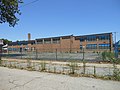
 Former Starling Middle School in Franklinton.jpg 3,374 × 1,899; 2.6 MB
-
 Franklinton - 31336446510.jpg 5,472 × 3,648; 1.05 MB
-
 Franklinton - 31336447820.jpg 5,472 × 3,648; 1.39 MB
-
 Franklinton - 31561418922.jpg 5,472 × 3,648; 1.25 MB
-
 Franklinton - 31561420872.jpg 4,696 × 3,131; 1.82 MB
-
 Franklinton - 31707933575.jpg 5,397 × 3,598; 1.74 MB
-
 Franklinton Apartments at Broad and Hawkes.jpg 3,872 × 2,592; 3.74 MB
-
 Franklinton Apartments at State and May.jpg 3,872 × 2,592; 4.41 MB
-
 Franklinton buildings 01.jpg 6,000 × 4,000; 11.79 MB
-
 Franklinton buildings 02.jpg 6,000 × 4,000; 11.77 MB
-
 Franklinton buildings 03.jpg 6,000 × 4,000; 11.49 MB
-
 Franklinton buildings 04.jpg 6,000 × 4,000; 12.04 MB
-
 Franklinton buildings 05.jpg 6,000 × 4,000; 11.86 MB
-
 Franklinton buildings 06.jpg 3,024 × 4,032; 3.65 MB
-
 Franklinton buildings 07.jpg 4,032 × 3,024; 5.23 MB
-
 Franklinton buildings 08.jpg 4,032 × 3,024; 4.34 MB
-
 Franklinton courthouse (cropped).jpg 1,131 × 1,715; 227 KB
-
 Franklinton courthouse.jpg 4,368 × 6,426; 2.53 MB
-
 Franklinton, Columbus 01.jpg 5,521 × 3,803; 15.89 MB
-
 Franklinton, Columbus 02.jpg 5,636 × 3,768; 19.55 MB
-
 Franklinton, Columbus 03.jpg 1,825 × 1,148; 1.3 MB
-
 Franklinton, Columbus 04.jpg 5,416 × 3,959; 13.04 MB
-
 Franklinton, Columbus 05.jpg 6,000 × 4,000; 19.1 MB
-
 Franklinton, Columbus 06.jpg 3,893 × 5,508; 10 MB
-
 Franklinton, Columbus 07.jpg 6,000 × 4,000; 15.68 MB
-
 Franklinton, Columbus 17.jpg 5,427 × 3,982; 13.18 MB
-
 Franklinton, Columbus 18.jpg 5,476 × 3,990; 12.29 MB
-
 Franklinton, Columbus, OH 01.jpg 4,000 × 2,250; 4.59 MB
-
 Franklinton, Columbus, OH 02.jpg 4,000 × 2,250; 3.7 MB
-
 Franklinton, Columbus, OH 03.jpg 3,939 × 2,216; 3.28 MB
-
 Franklinton, Columbus, OH 04.jpg 4,000 × 2,250; 3.14 MB
-
 Franklinton, Columbus, OH 06.jpg 3,197 × 1,798; 2.4 MB
-
 Franklinton, Columbus, OH 07.jpg 3,052 × 1,717; 2.01 MB
-
 Franklinton, Riverside-Bradley.jpg 3,246 × 2,191; 863 KB
-
 Franklinton.jpg 3,507 × 5,261; 1.55 MB
-
 Fretail.jpg 2,048 × 1,536; 757 KB
-
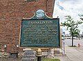
 Ftonplaque.jpg 2,048 × 1,536; 829 KB
-
 Glenwood Ave.jpg 5,456 × 3,632; 7.59 MB
-
 Gravity complex, Franklinton.jpg 3,239 × 2,139; 2.9 MB
-
 H. C. Godman Shoe Company factory building, photograph.jpg 904 × 716; 107 KB
-
 Handsome Homes of Columbus, Ohio - DPLA - 390a9745335ed62f65db0c1416729ffe (page 18).jpg 5,731 × 3,760; 4.22 MB
-
 Handsome Homes of Columbus, Ohio - DPLA - 390a9745335ed62f65db0c1416729ffe (page 80).jpg 5,643 × 3,760; 3.42 MB
-
 House by Franklinton Post Office.jpg 5,206 × 4,000; 17.51 MB
-
 Less Cat 4calls more Cats.jpg 3,648 × 5,472; 1.57 MB
-
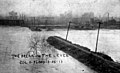 Levee Break Ohio 14357 .jpg 738 × 448; 50 KB
-
 Log House — Columbus, Ohio.jpg 2,500 × 1,886; 796 KB
-
 Mount Carmel Medical Center aerial view.jpg 3,262 × 2,227; 1.31 MB
-
 National Road marker, Columbus, OH 01.jpg 640 × 480; 101 KB
-
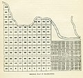 Platting Map.jpg 3,422 × 3,209; 1.48 MB
-
 River & Rich-crop.jpg 4,930 × 3,437; 10.56 MB
-
 River & Rich.jpg 5,334 × 3,717; 12.23 MB
-
 Sandusky Expressway - DPLA - 320a0958ee02c8901a03230938cf5799.jpg 3,259 × 2,212; 1.05 MB
-
 Schlee School - DPLA - 6505c8150ab32ce6432c9f9dfec7db8e (page 2).jpg 1,586 × 2,221; 792 KB
-
 Spaghetti Warehouse, Franklinton, Columbus, OH.jpg 4,032 × 3,024; 2.13 MB
-
 Starling Middle School-full.jpg 2,701 × 925; 987 KB
-
 Sullivant Ave. in Franklinton.jpg 4,000 × 2,250; 3.61 MB
-
 Sunshine Terrace.jpg 3,284 × 2,254; 1.31 MB
-
 The West Side Building and Loan Association.jpg 4,370 × 2,913; 6.57 MB
-
 Toledo and Ohio Central Railroad Passenger Station & Macklin Hotel.jpg 5,048 × 3,884; 1.79 MB
-
 Underpass to Franklinton.jpg 5,472 × 3,648; 1.5 MB
.jpg)
.jpg)

.jpg)
.jpg)
.jpg)
.jpg)
.jpg)
.jpg)


.jpg)


.jpg)
.jpg)


.jpg)


&filefrom=Uscrawl.jpg#mw-category-media)